
Projects
Bryce Gold Property
-
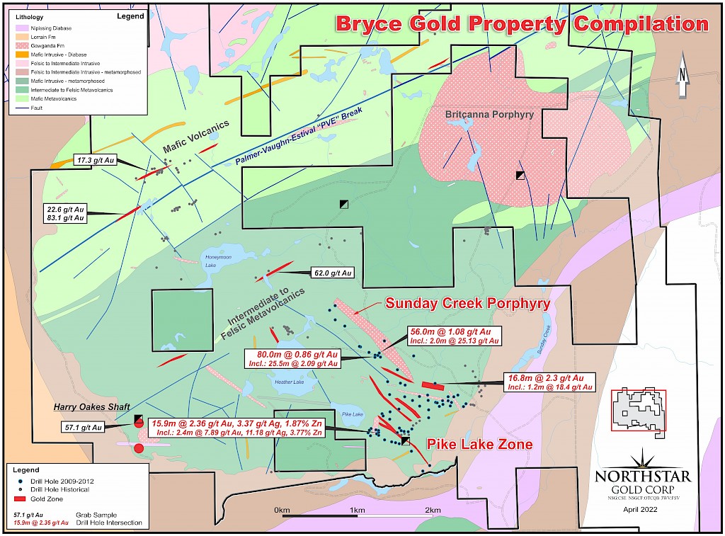
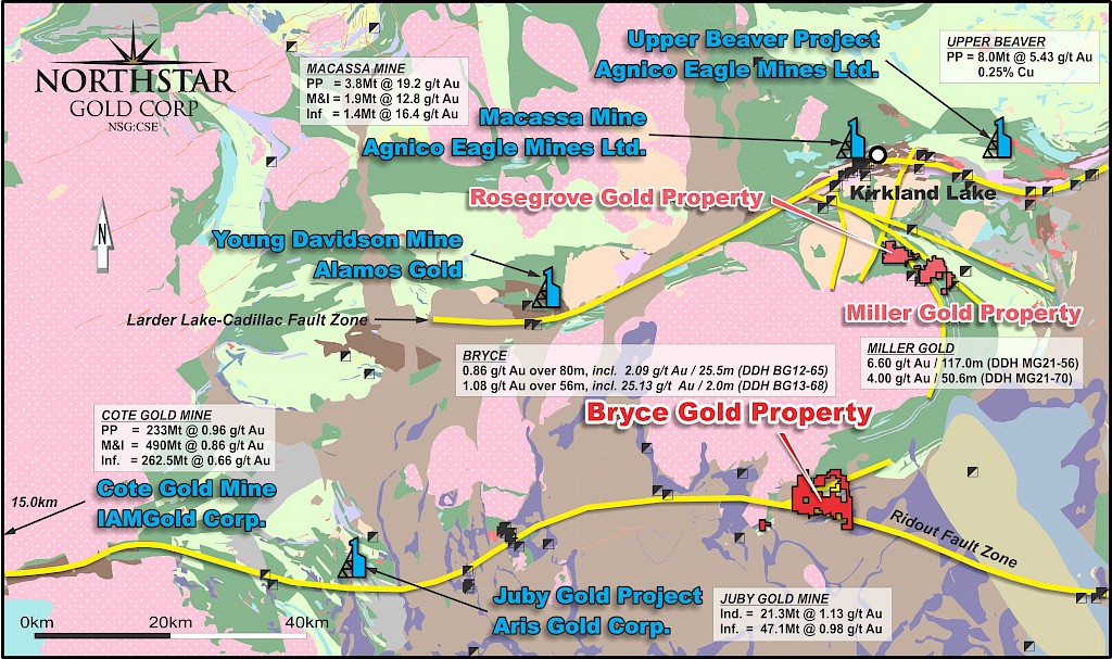
- 100% owned, 4,650-hectare property situated on the western extension of the Ridout Break, 65 km east of the Juby Gold Project and 35 kilometres south of Northstar’s flagship Miller Gold Property.
- Property hosts a variety of deposit types including porphyry related Au-Cu (Sunday Creek Porphyry), Au-rich Cu-Pb-Zn volcanogenic massive sulphides (Pike Lake Zone) and lode gold systems within an Abitibi multi-stage Archean porphyry / volcanic centre environment.
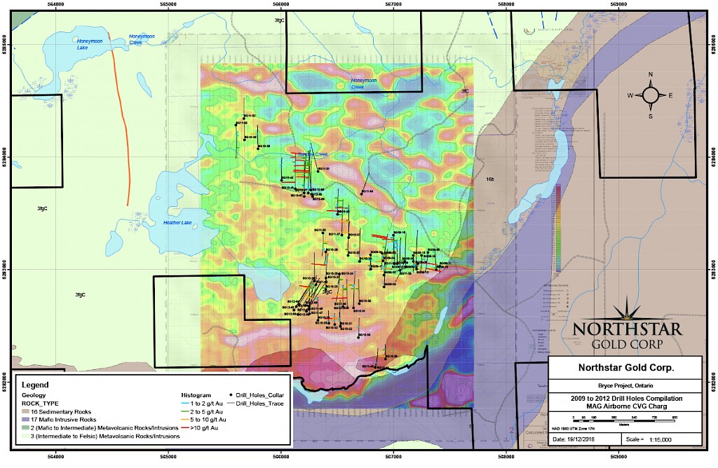
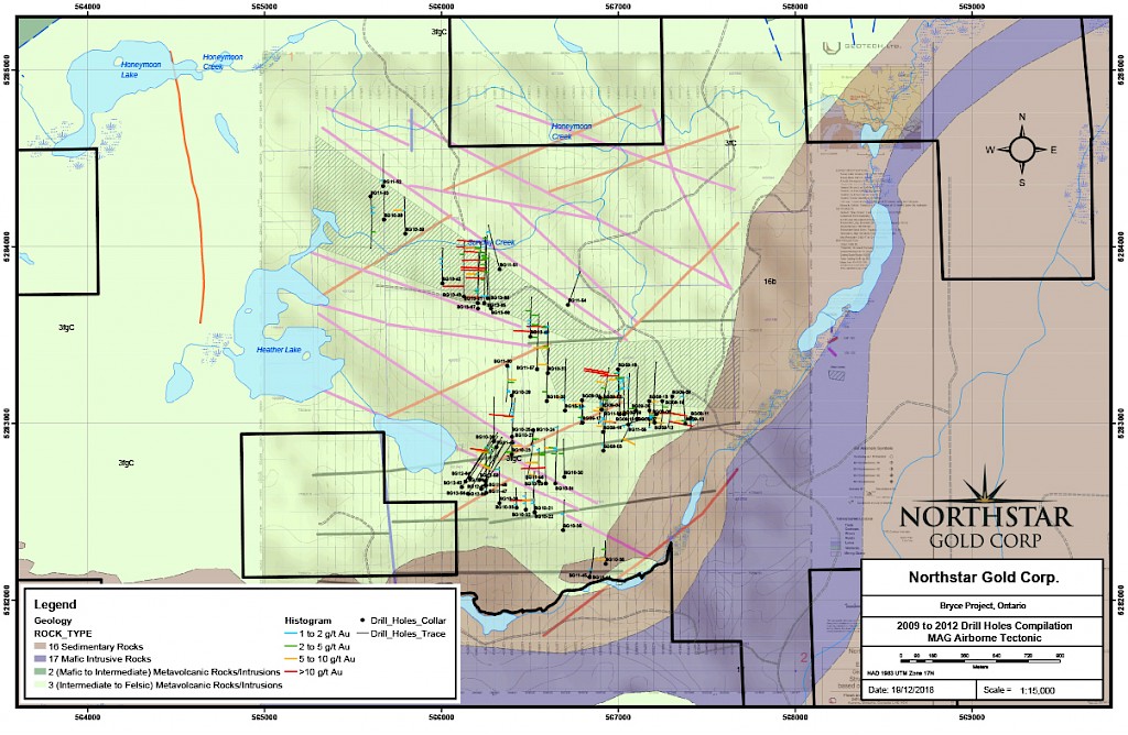
- 22,382 metres drilled by Northstar in 68 diamond drill holes from 5 phases of drilling between 2009 and 2013, covering only a small fraction of the total Property area.
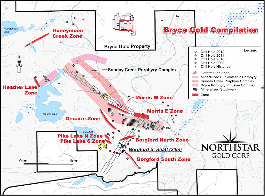
- 300 metre x 1500 metre Au-Cu Sunday Creek Porphyry discovery hosts a large scale stockwork-type Au-Cu porphyry system with widespread stringers and veins of high-grade gold mineralization open in all directions and expanding towards surface. Drill holes BG10-41 and BG12-65 returned 3.95 g/t Au over 5.5m, including 12.91 g/t Au over 1.5m and 0.86 g/t Au over 80 metres (including 2.09 g/t Au over 25.5 metres), respectively and drill hole BG13-68 averaged 1.08 g/t Au over 56 metres (including 25.13 g/t Au over 2.0 metres).
- The nearby Pike Lake Zone hosts a series of stacked lenses of gold-bearing semi-massive pyrite and sphalerite along a volcanogenic sedimentary exhalite horizon. Drill hole intercepts include 2.36 g/t Au, 3.37 g/t Ag and 1.87% Zn over 15.9 metres, including 7.89 g/t Au, 11.18 g/t Ag and 3.77% Zn over 2.4 metres (DDH BG11-47).
- Regional fault structures such as the Palmer-Vaughn-Estival “PVE” break hosting anomalous gold have been identified on surface, which could represent the eastern extension of the Ridout deformation zone.
- Several large IP targets and conductors remain untested.
- Potential for substantial near surface bulk tonnage gold resources around felsic intrusive centers.
- Several major, northeast-trending structures were interpreted from a 2021 LiDAR survey and magnetic survey in the northern and western part of the Property. Follow-up prospecting, sampling and mapping along the major northeast-trending fault (“PVE Fault”) and splays is warranted.
- A $528,500 exploration program including geological modeling, incorporating property-wide historic and Northstar geological data, and diamond drilling on the Sunday Creek and Pike Lake areas to further assess gold-bearing zones is recommended by Technical Report QP Trevor Boyd, PhD., P.Geo.
- Northstar’s plans to advance the Bryce Gold Property include a possible earn-in agreement or spin-out transaction.
- The Bryce Gold Property NI43-101 Technical Report can be viewed on Northstar’s website and SEDAR.
-
Maps